|
 Beautiful
Clearfield County was formed by parts of Lycoming and Huntingdon Counties
and was organized by the Act of Assembly on March 26, 1804.
Thomas McKean, governor of
the Pennsylvania Commonwealth during that period in time, approved the Act of
Assembly. Clearfield's name is derived from the clear fields that were found
along the
Clearfield Creek and in other areas of the county. These clearings were
most likely created from the Bison herds that formally roamed that area and from
the old corn fields of the Native Americans. The first Clearfield County
Commissioners were Roland Curtin,
James Fleming, and James Smith; all of which were appointed by Governor
McKean. Their first act as County Commissioners was to select a place to
construct a
county seat. On May 20, 1805, the commissioners arrived at land that was
owned by Abraham Witmer (the name in which lower and upper Witmer Parks, located
along the West Branch of Susquehanna waterfront in Beautiful
Clearfield County was formed by parts of Lycoming and Huntingdon Counties
and was organized by the Act of Assembly on March 26, 1804.
Thomas McKean, governor of
the Pennsylvania Commonwealth during that period in time, approved the Act of
Assembly. Clearfield's name is derived from the clear fields that were found
along the
Clearfield Creek and in other areas of the county. These clearings were
most likely created from the Bison herds that formally roamed that area and from
the old corn fields of the Native Americans. The first Clearfield County
Commissioners were Roland Curtin,
James Fleming, and James Smith; all of which were appointed by Governor
McKean. Their first act as County Commissioners was to select a place to
construct a
county seat. On May 20, 1805, the commissioners arrived at land that was
owned by Abraham Witmer (the name in which lower and upper Witmer Parks, located
along the West Branch of Susquehanna waterfront in
Clearfield Borough, are named). At that time, the town was known as
Chincleclamousche, named after the Native American chief of the Cornplanter's
tribe of Senecas.
Clearfield County was not a totally independent entity, however. In 1812,
Clearfield County formed its first board of commissioners: Robert Maxwell, Hugh
Jordan, Samuel Fulton, and Arthur Bell Sr. This assembly worked for the next
ten years to pass a law that fully organized Clearfield County as a fully
independent county. This Act of Assembly was passed on January 29, 1822.
Clearfield County's major industries, during this period of time, were the
lumber yards and
coal mining beds that littered the county. Lumber was still being
floated down the West Branch of the
Susquehanna River until 1917, when the railroads were brought in to the
major towns of the county. Coal was, and remains to be, one of the major
industries in the county. The "black diamonds" are still being mined today,
though the majority of coal removal is done by strip mining.
Little known fact: Clearfield County's first inhabitant was Captain Edward
Rickert's, back in 1784, on the site that is now known as Coalport.
Additionally, the county is situated in the largest estuary in the US, the
Chesapeake Bay Watershed.
There are plenty of opportunities for every interest from the outdoorsman,
businessman, shopper, to the art lover. For instance, the Clearfield County
Rails-to-Trails
program offers a railroad view of Clearfield, Curwensville, and
Grampian. The trailway is parallel with most of Route 879 and the West Branch
of the Susquehanna River. For the offroader, in some of us, there are PLENTY of
back roads, mud pits, and
awesome trails scattered throughout the county, and most of
Pennsylvania. Hunting is
also another famed outdoor sport in Pennsylvania and Clearfield County. With
plenty of game lands and wooded areas, you're bound to find your trophy
whitetail buck, black bear, and even elk. PA offers archery, rifle, handgun,
and black powder licenses. PA also offers several small game hunting as well.
Duck, squirrel, turkey, pheasant, ruffed grouse (our state bird), and rabbit are
just a small sample of the small
game found throughout Clearfield County.
Have some good ol' fun with your family throughout the county. Many of the
local towns offer a parade for their anniversaries. Clearfield celebrates its
birth during the
Clearfield County
Fair. Nearby Curwensville offers the "Curwensville Days" event, as
does Grampian and other local municipalities. These fine events are filled with
activities, games, plenty of great food, awesome music, a variety of events, and
other impressive surprises.
Clearfield County Boroughs
 Burnside
is situated directly north of Cherry Tree and is the namesake of the township.
The borough was incorporated in 1874. As with much of the little towns
throughout Clearfield County, this town was thriving and rich during the late
1800s and early 1900s with lumber. Now, this small town is only known for
the sprawling farmland. Currently, there are approximately 500 residents
of Burnside. Burnside
is situated directly north of Cherry Tree and is the namesake of the township.
The borough was incorporated in 1874. As with much of the little towns
throughout Clearfield County, this town was thriving and rich during the late
1800s and early 1900s with lumber. Now, this small town is only known for
the sprawling farmland. Currently, there are approximately 500 residents
of Burnside. |
 Clearfield Borough, located nearly in the center of Clearfield County
and is the county seat, began when Daniel Ogden, in 1797, first saw this land and saw that the cleared fields were covered by buffalo grass. He noticed that the bison herds didn't seem
to harm the growth of this grass. In hopes of obtaining his own supply of
hay, he fenced in the area and cut the grass. After cutting the buffalo
grass, it never grew back. This resulted in the bison leaving the area. Clearfield Borough, located nearly in the center of Clearfield County
and is the county seat, began when Daniel Ogden, in 1797, first saw this land and saw that the cleared fields were covered by buffalo grass. He noticed that the bison herds didn't seem
to harm the growth of this grass. In hopes of obtaining his own supply of
hay, he fenced in the area and cut the grass. After cutting the buffalo
grass, it never grew back. This resulted in the bison leaving the area.
Lots in Clearfield were initially sold for $30 to $50. At one point,
though, the cost for a lot dwindled to $1.50 to $2. During this time,
there was only one tavern, a tannery, and approximately ten homes
In 1840, Clearfield was established as a borough and the town began to flourish
with churches, a railroad line, and manufacturing industries. The earliest
settlers to Clearfield were Josiah W. Smith, Robert Collins, Ann Leathers,
the Valentines, Andrew Bowers, Thomas Hemphill, Orris Hoyt, Ebenezer McGee, A.
B. Reed, and Richard Shaw.
Notable current residents
and natives from Clearfield include former Houston Astros relief pitcher
Doug Brocail, journalist
Earl Caldwell, attorney and politician
William Wallace, Wisconsin Governor
Edward
Scofield, US Representative
William Swoope, and 40+ year Clearfield Broadcaster Bob E Day.
|
|
 Curwensville
is located southwest of Clearfield Borough and is named for the land that John
Curwen founded and occupied in 1799. John Curwen is originally from
Montgomery County and was actually never a true citizen of Clearfield
County. Curwensville became the second borough of Clearfield County in
1851. This quaint town was one of the many lumbering cities that
flourished financially, mainly due to the access to the West Branch of the
Susquehanna River. Curwensville
is located southwest of Clearfield Borough and is named for the land that John
Curwen founded and occupied in 1799. John Curwen is originally from
Montgomery County and was actually never a true citizen of Clearfield
County. Curwensville became the second borough of Clearfield County in
1851. This quaint town was one of the many lumbering cities that
flourished financially, mainly due to the access to the West Branch of the
Susquehanna River.
The
Curwensville Lake
provides the boater and fisherman as well as the beachgoer a relaxing place to
enjoy the local waterways. In addition, this area provides camping, picnic
areas, and a volleyball court.
Curwensville was also known for providing six lawyers to being the Supreme Court
bench. Curwensville began the first Sunday School in Clearfield County on
May 16, 1824. The attendees were Thomas McClure, Alexander Caldwell, John
P. Hoyt, Josiah Evans, Abram Bloom, Ann Reed, Eliza Howe, Susan Henry, Elizabeth
Henry, Pamelia R. Derush, Phianid Mullen, Sarah Evans, Nancy L. Hartshorn,
Priscilla R. Evans, Catharine Bloom, Mary Ann G. Hartshorn, Hannah England,
Eliza Stage, Jane Reed, Samuel Reed, Samuel Henry, Hugh Fullerton, Hugh A.
Caldwell, Thomas Bloom, Isaac Stage, Nathan Bailey, Jonathan Evans, Johnathan
Hartshorn, William Askey, Andrew Ross, Davis Askey, William Bloom, William
Hartshorn, William Blair, Henrietta Ann Reed, Samuel Blow, William A. Blow,
Charlotte Stage, William Harley, Margaret Blow, Mary Blow, Ellis Askey, James A.
Bloom, Nancy Bloom, Robert McNaul, Zachariah McNaul, and James Askey.
Notable native and resident
director for Pres. George Washington's estate,
Charles Wall.
|
 Du Bois,
the original spelling of the city, was originally known as Rumbarger. This
city was originally settled in 1812 and incorporated as a borough in 1881. Du Bois,
the original spelling of the city, was originally known as Rumbarger. This
city was originally settled in 1812 and incorporated as a borough in 1881.
In
1865, John Rumbarger purchased land that was situated along the Allegheny Valley
Railroad. In mid-1872, Mr. Rumbarger planted the town named after
himself. Around the same time of naming the town Rumbarger, a gentleman by
the name of John Du Bois had engineered a vast array of improvements to the town
to include the railroad station which was named Du Bois. The town
leadership ended up changing
the name from Rumbarger to the presently known Du Bois, presently spelled DuBois
(pronounced Du Boys). In 1914, DuBois was finally incorporated into a
city.
The City of DuBois is and
has been well-known for having a local brewery, known as DuBois Brewery.
This brewery produced four products: DuBois Wurzburger, Hahne's Export Pilsener,
DuBois Porter, and DuBois Budweiser. The latter named product
unfortunately caused the early demise of the brewery in 1972 due to a copyright
infringement dispute for the use of the name "Budweiser."
Notable natives of DuBois
include left-handed pitcher for the Chicago Whitesox
Albert "Sparky" Lyle, western actor
Tom Mix,
retired US Army Major General and Fox News military analyst
Paul
Vallely, USAF Colonel and WWII Ace Fighter Pilot
Charles MacDonald, NASCAR Racer
Benny Gordon, and
Pitcher for both the Kansas City Royals and Milwaukee Brewers
Jim Pittsley. |
 Frenchville
was settled in 1835 by a couple of
French settlers, however, M. Zavron from Paris, France, had failed to pay a
certain debt to his Philadelphia based agent, John Keating. Because of
this, John Keating acquired land, now known as Frenchville, to pay for M.
Zavron's debt. M. Zavron had a German agent aid him in immigrating
families to this town to settle the land. Originally, the town language
was a dialect called North American French, also known as moribund. Photo
by Barbara Bullock via the
University of Texas. Frenchville
was settled in 1835 by a couple of
French settlers, however, M. Zavron from Paris, France, had failed to pay a
certain debt to his Philadelphia based agent, John Keating. Because of
this, John Keating acquired land, now known as Frenchville, to pay for M.
Zavron's debt. M. Zavron had a German agent aid him in immigrating
families to this town to settle the land. Originally, the town language
was a dialect called North American French, also known as moribund. Photo
by Barbara Bullock via the
University of Texas. |
 Houtzdale
is located west of Osceola Mills in Woodward Township. The town gets its
name from Dr. Houtz, the original owner of the land, but was actually developed
by a well known business man, at the time, G. N. Brisbin. The borough of
Houtzdale was built out necessity due to the wealth of coal beds and the
business it brought to the town. Houtzdale was rapidly organized as a
borough in 1871 because of its growth. Houtzdale
is located west of Osceola Mills in Woodward Township. The town gets its
name from Dr. Houtz, the original owner of the land, but was actually developed
by a well known business man, at the time, G. N. Brisbin. The borough of
Houtzdale was built out necessity due to the wealth of coal beds and the
business it brought to the town. Houtzdale was rapidly organized as a
borough in 1871 because of its growth.
This quaint little burg is
currently known for housing a medium-security State Correctional Institution,
which opened in 1996. It is also home to PA Representative Camille George.
|
 Luthersburg,
named after a Massachusetts native Lebbeus Luther who bought the property in
1820, is located in Brady Township, south of Du Bois. Luthersburg was
known mostly as a German settlement. Luthersburg,
named after a Massachusetts native Lebbeus Luther who bought the property in
1820, is located in Brady Township, south of Du Bois. Luthersburg was
known mostly as a German settlement. |
 Osceola Mills,
once known as Osceola, was a very thriving town with the Tyrone & Clearfield
Railroad directly connected to this borough. Osceola Mills was actually
laid out by Centre County parties, in 1859 that were primarily interested in the
vastness of pine and hemlock lumber forests. Along with the forests, there
was a great source of coal beds that laid under those forests. It was
established as a borough in 1864. Osceola Mills is located along Centre
County in Decatur Township. Osceola Mills,
once known as Osceola, was a very thriving town with the Tyrone & Clearfield
Railroad directly connected to this borough. Osceola Mills was actually
laid out by Centre County parties, in 1859 that were primarily interested in the
vastness of pine and hemlock lumber forests. Along with the forests, there
was a great source of coal beds that laid under those forests. It was
established as a borough in 1864. Osceola Mills is located along Centre
County in Decatur Township.
In the year 1863, the Osceola area had thirteen large saw mills, most of which
were owned by The Moshannon Land and Lumber Company. The company was
capable of producing over 75,000 feet of lumber per day.
|
Grampian Hills, now called
Grampian, was named by Dr. Samuel Coleman for its resemblance to very similar
hills located Scotland. Grampian was first settled in 1805 by Quakers.
The borough is located west of Curwensville.
Kylertown
was a coal mining town, as were many others, because of the coal beds. The
town is located in Morris Township, east of Clearfield.
Lumber City
comes by its name naturally for the wealth of business in the lumber
industry. It is located along the West Branch of the Susquehanna River,
southwest of Curwensville. The river provided great lumber shipments by
many vehicles. Arks, known at that time as lumber boats or rafts, were
once built to ship the lumber to various points along the river. During
the flood season, the lumber yards would flourish with a wealth of
shipments. Lumber City was established in 1857 and incorporated the
following year.
New Washington
was an enterprising town that was created in 1859. The town is located in
Burnside Township, east of Burnside Borough.
Wallaceton
was one of the many railroad stops along the Tyrone & Clearfield
Railroad. The small village was laid out in 1868 but wasn't incorporated
until 1873. It is located in Boggs Township and southeast of Clearfield
Borough.
Clearfield
County Townships
|

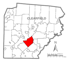
Beccaria Township, located along the southern part of Clearfield County,
derived its name from the Italian philosopher Marquis De Beccaria. During
the township's beginning, the area was known for the improved farming and
immense coal deposits. The first setters were Henry Dillon and Samuel
Smiley (known for beginning farms on Mt. Pleasant), Isaac Rickets (one of the
earliest chain carriers for the first surveyors), Samuel Heggerty, William
Wright, and Abram Keagy.
|
 Bell Township resides north of Burnside Township and was named for the
first settlers, the Arthur Bell Jr. family. This little township is famous
for having the only covered bridge crossing over the West Branch of the
Susquehanna River. Bell Township resides north of Burnside Township and was named for the
first settlers, the Arthur Bell Jr. family. This little township is famous
for having the only covered bridge crossing over the West Branch of the
Susquehanna River.
The McGees Mills
Covered Bridge rests in this
southwestern township. |
 Bigler
Township named after the Honorable William Bigler, former Governor of PA,
the township was formed from the surrounding townships of Woodward, Beccaria,
Knox, and Geulich. Documents and research argue the actual year the
township was formed whether 1881 or 1883. Bigler
Township named after the Honorable William Bigler, former Governor of PA,
the township was formed from the surrounding townships of Woodward, Beccaria,
Knox, and Geulich. Documents and research argue the actual year the
township was formed whether 1881 or 1883. |
 Bloom Township was given its name for the numerous Bloom Families that
resided in Clearfield County. The township is located west of Pike
Township and east of Brady Township with its earliest settlers being Judge and
James Bloom, Isaac Draucker, and Isaac Rodden. Bloom Township was given its name for the numerous Bloom Families that
resided in Clearfield County. The township is located west of Pike
Township and east of Brady Township with its earliest settlers being Judge and
James Bloom, Isaac Draucker, and Isaac Rodden.
One of the attractions,
besides the many acres of wooded land, is the rock formation called Bilger's Rocks.
|
 Boggs Township, located south of Bradford Township, gets its name from
Associate Judge Boggs. The first settlers were Jacob Haney, Quaker George
Wilson, Nimrock Derrick, John Wisor, Philip Bennihoof, Henry Shimes, Adsalom
Timms, George Turner, and Peter Young. Boggs Township, located south of Bradford Township, gets its name from
Associate Judge Boggs. The first settlers were Jacob Haney, Quaker George
Wilson, Nimrock Derrick, John Wisor, Philip Bennihoof, Henry Shimes, Adsalom
Timms, George Turner, and Peter Young. |
 Bradford Township is located east of Clearfield Boro and Lawrence
Township and is named after General Bradford, a Pennsylvanian surveyor.
Bradford Township was best known for its agricultural community and the wealth
of coal deposits. The earliest settlers were Ross, John Kyle, Conrad Kyle,
George Kyle, Jacob Kyle, Benjamin Smeal, George Smeal, John Graham, William
Graham, the Mains Family, Thomas Forcey, Samuel Harrier, Cæsar Poter, and Henry
Funk. Bradford Township is located east of Clearfield Boro and Lawrence
Township and is named after General Bradford, a Pennsylvanian surveyor.
Bradford Township was best known for its agricultural community and the wealth
of coal deposits. The earliest settlers were Ross, John Kyle, Conrad Kyle,
George Kyle, Jacob Kyle, Benjamin Smeal, George Smeal, John Graham, William
Graham, the Mains Family, Thomas Forcey, Samuel Harrier, Cæsar Poter, and Henry
Funk.
|
|
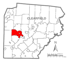
 Brady Township, located along the northwestern part of Clearfield County,
got its name from Captain Samuel Brady. Capt. Brady was known as the first
"white man" to settle in the area with the Native Americans.
From the formation of Brady Township, the town of Luthersburg and the city DuBois
were created. Brady Township, located along the northwestern part of Clearfield County,
got its name from Captain Samuel Brady. Capt. Brady was known as the first
"white man" to settle in the area with the Native Americans.
From the formation of Brady Township, the town of Luthersburg and the city DuBois
were created.
|
 Burnside Township, located on the southwestern corner of Clearfield
County, was organized from a part of Chest Township. The first settlers to
Burnside Township were Senator James Gallaher, Senator John Byers, Ludwick
Snyder, and Jacob Lee. Burnside Township, located on the southwestern corner of Clearfield
County, was organized from a part of Chest Township. The first settlers to
Burnside Township were Senator James Gallaher, Senator John Byers, Ludwick
Snyder, and Jacob Lee.
This township is best known for its historical presence in forming the state of
Pennsylvania. William Penn's agents, which were in the process of
purchasing the land from the Native Americans, were set floating down the West
Branch of the Susquehanna River when their canoe ran into an embankment.
The point, in which they stopped, was against a Cherry Tree. The
name of the town that was formed near this location. William Penn's
agreement with the Native Americans was to go as far west as he could with a
canoe on the West Branch of the Susquehanna River; he was also told to go as far
west from the cherry tree by land as he could in one full day. The journey
brought Penn's agents to the Allegheny River, where the present day Kittanning
resides, the county seat of Armstrong County. The purchase included a
portion of land attached to Lake Erie and New York State on the north and West
Virginia on the south. This purchase later gave us what was once called
Penns Woods or presently known as Pennsylvania. Both the Bell and Chest
Townships share the same historical facts as Burnside Township.
|
|
 Chest Township, located east of Burnside Township, was given its name for
the Chest Creek that flows through the township. The original settlers to
Chest Township were Thomas Wilson, Elias Hurd, Rorabaugh, Neff, Samuel McKewen,
James Curry, and Jacob Pentico. Chest Township, located east of Burnside Township, was given its name for
the Chest Creek that flows through the township. The original settlers to
Chest Township were Thomas Wilson, Elias Hurd, Rorabaugh, Neff, Samuel McKewen,
James Curry, and Jacob Pentico.
|
 Covington Township is known for its thriving French Settlement that
originates back to 1835. The township is located west of Karthaus Township
and was settled by John Smith, the Jacob Family, the Jones Family, the Brown
Family, and the Gearheart Family. Covington Township is known for its thriving French Settlement that
originates back to 1835. The township is located west of Karthaus Township
and was settled by John Smith, the Jacob Family, the Jones Family, the Brown
Family, and the Gearheart Family.
|
|
 Decatur Township is located south of Boggs Township and is best known
for the anthracite coal deposits that were chiefly used for locomotive and
steamship uses. Decatur Township is named for Commodore Stephen
Decatur. The earliest settlers were Revolutionary War soldier of 1799
Abram Goss, John Crowell, Daniel Huffman, and Valentine Flegal. Decatur Township is located south of Boggs Township and is best known
for the anthracite coal deposits that were chiefly used for locomotive and
steamship uses. Decatur Township is named for Commodore Stephen
Decatur. The earliest settlers were Revolutionary War soldier of 1799
Abram Goss, John Crowell, Daniel Huffman, and Valentine Flegal.
|
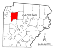
 Ferguson Township, located northwest of Jordan Township and northeast of
Chest Township, was organized from the original Pike and Beccaria
Townships. The township's name comes from John Ferguson Sr., one of the
earliest pioneers to the township. Arthur Bell was actually the original
settler to Ferguson Township, arriving around the year 1797. Ferguson Township, located northwest of Jordan Township and northeast of
Chest Township, was organized from the original Pike and Beccaria
Townships. The township's name comes from John Ferguson Sr., one of the
earliest pioneers to the township. Arthur Bell was actually the original
settler to Ferguson Township, arriving around the year 1797.
|
|
 Geulich, today spelled Gulich, Township was made in honor of G. Philip
Geulich. Judge James Burnside called him a "great friend of religion
and morals." Gulich Township is located on the southeastern corner of
Clearfield County. It is also among the list of earlier coal producing and
lumber yielding townships of its earlier days. The earliest settlers were
Abram Nevling, Amasa Smith, Lisle McCully, Joseph McCully, Schooly Scott, and
the Ginter Family. The township has the highest
percentage of Ukranian ancestors in the county at over 12%. Geulich, today spelled Gulich, Township was made in honor of G. Philip
Geulich. Judge James Burnside called him a "great friend of religion
and morals." Gulich Township is located on the southeastern corner of
Clearfield County. It is also among the list of earlier coal producing and
lumber yielding townships of its earlier days. The earliest settlers were
Abram Nevling, Amasa Smith, Lisle McCully, Joseph McCully, Schooly Scott, and
the Ginter Family. The township has the highest
percentage of Ukranian ancestors in the county at over 12%.
|
 Girard Township was mostly an agricultural community and derives its
name in memory of Stephen Girard. The township is located north of
Bradford Township and west of Covington Township. The original pioneers to
settle here were Thomas Leonard, John Spackman, Abram Jury, George B. Smith,
Peter Lamb, and Augustus and Alphonse Leconte. Girard Township was mostly an agricultural community and derives its
name in memory of Stephen Girard. The township is located north of
Bradford Township and west of Covington Township. The original pioneers to
settle here were Thomas Leonard, John Spackman, Abram Jury, George B. Smith,
Peter Lamb, and Augustus and Alphonse Leconte.
|
|
 Goshen Township, located east of Lawrence and west of Girard Townships,
and gets its name from one of the earliest settlers William Leonard believing
that this land was "a land flowing with milk and honey." The
land consisted of many groves of timber in the north and farmers found great
return from the land and was held in high regards with Mr. Leonard's name
Goshen. The first settlers were Mr. Leonard, Jacob Flegal, and Robert
Shaw. Goshen Township, located east of Lawrence and west of Girard Townships,
and gets its name from one of the earliest settlers William Leonard believing
that this land was "a land flowing with milk and honey." The
land consisted of many groves of timber in the north and farmers found great
return from the land and was held in high regards with Mr. Leonard's name
Goshen. The first settlers were Mr. Leonard, Jacob Flegal, and Robert
Shaw.
|
 Graham Township, located east of Bradford Township, was first settled by
Samuel Turner, the Mains Family, Edmund Williams, Jacob Hubler, Basil Crowell,
Conrad Kyler, and William Hitchins. The township is named in honor of
James B. Graham. Graham Township, located east of Bradford Township, was first settled by
Samuel Turner, the Mains Family, Edmund Williams, Jacob Hubler, Basil Crowell,
Conrad Kyler, and William Hitchins. The township is named in honor of
James B. Graham.
|
|
 Greenwood Township is the last township to be organized in Clearfield
County. The name is derived from Greenwood Bell, one of the earliest
settlers to this area. Other pioneers included Dr. Hoyt and Lewis Smith. Greenwood Township is the last township to be organized in Clearfield
County. The name is derived from Greenwood Bell, one of the earliest
settlers to this area. Other pioneers included Dr. Hoyt and Lewis Smith.
|
 Huston Township was named after the first judge of Clearfield County,
Judge Charles Huston. The township is located in the northwest corner of
Clearfield County and was known for being the best place for agricultural
wealth. The first settlers were Isaac Wilson, John Hewitt, Thomas Bliss,
Martin Nichols, the Bundy Family, and the Lamb Family. Huston Township
also houses Parker Dam State Park. Huston Township was named after the first judge of Clearfield County,
Judge Charles Huston. The township is located in the northwest corner of
Clearfield County and was known for being the best place for agricultural
wealth. The first settlers were Isaac Wilson, John Hewitt, Thomas Bliss,
Martin Nichols, the Bundy Family, and the Lamb Family. Huston Township
also houses Parker Dam State Park.
|
|

Jordan Township is situated northeast of Chest Township and was the
namesake of Associate and former Revolutionary War soldier Judge Jordan. Jordan Township is best known for
beginning one of the first meeting houses in Clearfield County. Reverend
James Anderson, one of the first settlers, began the Presbyterian-based Fruit
Hill church. The Jordan Township motto is "No Step Backward,"
which originally referred to the agriculture in the township.
The first settlers were James Rea, John Swan, the Patterson Family, Truman Viets,
John Thompson, James McNeel, Captain Cyrus Thurston, William Williams, Thomas
Davis, and Robert and James Johnston.
|
 Karthaus
Township, located in the northeast corner of Clearfield County, is best
known for its immense bed of iron ore and the coke furnace in which the
manufacturing of pig iron was made. The township is named after Peter Arns
Karthaus, one of the earliest settlers who owned a majority of the land.
Among Mr. Karthaus, there was J. F. W. Schnarrs, Henry Buck Graham, and Yothers
and Conoway. Karthaus
Township, located in the northeast corner of Clearfield County, is best
known for its immense bed of iron ore and the coke furnace in which the
manufacturing of pig iron was made. The township is named after Peter Arns
Karthaus, one of the earliest settlers who owned a majority of the land.
Among Mr. Karthaus, there was J. F. W. Schnarrs, Henry Buck Graham, and Yothers
and Conoway. |
|
 Knox Township is located directly north of present day Beccaria
Township. Knox Township was originally included in Beccaria Township until
the formation of Jordan Township. The township was named in honor of
presiding Judge Knox, in 1853. During Knox and Jordan Township's
beginning, the original owners Peters, Rowls, and Morgan offered an incentive to
anyone that settled in the two townships, 50 acres of land for free.
People could purchase an additional 50 acres of land for a low price.
James Rea, Hegerty, James McKee, and Robert Patterson were among the first
settlers to take advantage of this great bargain. Knox Township is located directly north of present day Beccaria
Township. Knox Township was originally included in Beccaria Township until
the formation of Jordan Township. The township was named in honor of
presiding Judge Knox, in 1853. During Knox and Jordan Township's
beginning, the original owners Peters, Rowls, and Morgan offered an incentive to
anyone that settled in the two townships, 50 acres of land for free.
People could purchase an additional 50 acres of land for a low price.
James Rea, Hegerty, James McKee, and Robert Patterson were among the first
settlers to take advantage of this great bargain.
|
 Lawrence Township,
located on the northern edge of the West Branch of Susquehanna River, was named
after Commodore Lawrence. The original relationship to Clearfield County
and the Susquehanna River was that it was the agriculture region for the
area. The first settlers were Jacob Haney, Archibald Shaw, John Owens,
William Tate, Henry and John Irwin, Alexander Irvin, Solomon and John Kline,
Hugh McMullen, Isaac Goom, Alexander B. and James Reed, Thomas, William, James,
Alexander, and Amos Reed Lawrence Township,
located on the northern edge of the West Branch of Susquehanna River, was named
after Commodore Lawrence. The original relationship to Clearfield County
and the Susquehanna River was that it was the agriculture region for the
area. The first settlers were Jacob Haney, Archibald Shaw, John Owens,
William Tate, Henry and John Irwin, Alexander Irvin, Solomon and John Kline,
Hugh McMullen, Isaac Goom, Alexander B. and James Reed, Thomas, William, James,
Alexander, and Amos Reed
|
|
 Morris Township, situated to the east of Boggs Township, was best known
for its coal works and large shipping yards. Morris Township was named
after Robert Morris. The first settlers to the township were Leonard
and Abram Kyler, David Cooper, Jacob Gearheart, Jacob Wise, James Seport, and
William Shimel. Morris Township, situated to the east of Boggs Township, was best known
for its coal works and large shipping yards. Morris Township was named
after Robert Morris. The first settlers to the township were Leonard
and Abram Kyler, David Cooper, Jacob Gearheart, Jacob Wise, James Seport, and
William Shimel.
|
 Penn Township is comfortably situated to the east of Bell Township and
northwest of Ferguson Township. The township was originally part of Pike
Township but was made an independent township for the original settlers, the
Quakers, because of the jealousy which formed because of being located in a
different part of Pike Township. The presiding Judge Burnside liked the
Quakers and permitted that there be a new township. Penn Township is comfortably situated to the east of Bell Township and
northwest of Ferguson Township. The township was originally part of Pike
Township but was made an independent township for the original settlers, the
Quakers, because of the jealousy which formed because of being located in a
different part of Pike Township. The presiding Judge Burnside liked the
Quakers and permitted that there be a new township.
The earliest settlement to Penn Township was Dr. Samuel Coleman in which he was
given 300 acres, from the company lands of Hopkins, Griffith, and Bown (who
collectively owned approximately 40,000 acres), if he moved from Centre
County. He made his way in a kneel bottom boat on the West Branch of the
Susquehanna River to a point two and a half miles above Curwensville.
After landing, a road was cut that lead to the plot of land and there Dr.
Coleman settled in a rude hut of logs.
James Moore was also one of the earliest settlers and purchased 300 acres of
land where the present day Pennville resides.
|
|
 Pike Township, located northwest of Lawrence Township, was named after
General Zebulon Pike. Pike, along with several other townships, were
chiefly lumbering areas, however that industry began to fade in the
1870's. The original settlers to Pike Township were Paul Clover, Thomas
McClure, the Blooms, William McNaul, Elisha Fenton, John Smith, Robert Ross,
Samuel Caldwell, William Dunlap, the Hartshorns, Robert Maxwell, Dr. Hoyt, James
McCracken, the Roll Family, Hugh Hall, John Irvin, and William and Daniel
Barrett. Pike Township, located northwest of Lawrence Township, was named after
General Zebulon Pike. Pike, along with several other townships, were
chiefly lumbering areas, however that industry began to fade in the
1870's. The original settlers to Pike Township were Paul Clover, Thomas
McClure, the Blooms, William McNaul, Elisha Fenton, John Smith, Robert Ross,
Samuel Caldwell, William Dunlap, the Hartshorns, Robert Maxwell, Dr. Hoyt, James
McCracken, the Roll Family, Hugh Hall, John Irvin, and William and Daniel
Barrett.
Matthew Caldwell, one of the earlier settlers to Pike Township, cut out the
first road that was made from the towns of Curwensville and Bloomington.
|
 Pine Township is located east of Union and north of Pike Townships and
gets its name from the wealth of pine trees. Pine Township is located east of Union and north of Pike Townships and
gets its name from the wealth of pine trees. |
|
 Sandy
Township is named after the Sandy Lick Creek which traverses through and was
formed in 1878 from portions of Brady, Huston, and Union townships.
According to www.SandyTownship.org,
the township was formed out of great struggles and "discontent in the vicinity
of DuBois." The first major industry was the Sandy Lick Gas, Coal, and
Coke Company which birthed many transportation venues such as the railroad,
highway, interstate, and eventually a regional airport. Sandy
Township is named after the Sandy Lick Creek which traverses through and was
formed in 1878 from portions of Brady, Huston, and Union townships.
According to www.SandyTownship.org,
the township was formed out of great struggles and "discontent in the vicinity
of DuBois." The first major industry was the Sandy Lick Gas, Coal, and
Coke Company which birthed many transportation venues such as the railroad,
highway, interstate, and eventually a regional airport.
Today, the township
contains the DuBois Mall,
Treasure Lake,
three major business plazas, the DuBois branch of
Penn State University,
and many other great businesses and entities within. |
 Union Township derived its name from the "union" of Pike and
Brady Townships. It is located south of Huston, east of Brady, and north
of Bloom Townships. Lumbering and agriculture, as with other townships,
were the chief industries during the township's formation. The earliest
settlers were John Brubaker, Wilson Moore, Jacob Burns, and Laborde. Union Township derived its name from the "union" of Pike and
Brady Townships. It is located south of Huston, east of Brady, and north
of Bloom Townships. Lumbering and agriculture, as with other townships,
were the chief industries during the township's formation. The earliest
settlers were John Brubaker, Wilson Moore, Jacob Burns, and Laborde. |
|
 Woodward Township named after Supreme Court Judge Woodward is located to
the west of Decatur Township. The township, like Decatur, Morris, and
other townships, was known for its coal beds and lumbering production. The
first inhabitants were Samuel and Henry Heggerty. Woodward Township named after Supreme Court Judge Woodward is located to
the west of Decatur Township. The township, like Decatur, Morris, and
other townships, was known for its coal beds and lumbering production. The
first inhabitants were Samuel and Henry Heggerty.
|
|
Clearfield
County State Parks

S. B. Elliot State Park is located off of Exit 111, formerly Exit 18, of
Interstate 80. In 1933, the park was dedicated in honor of Honorable Simon
B. Elliot who was a member of both the Pennsylvania Legislature and the State
Forestry Reservation Commission, the predecessor to Department of
Forestry. He was one of the states' earliest conservationists who
continued to promote the idea of tree nursery's to encourage rebuilding the
forests.
In the S. B. Elliot Park's early days, it was a mountain top rich
with pine and hemlock trees. During the 1800's into the early 1900's,
lumber was a great and wealthy industry, much like computers and electronics are
today. During the early 1900's, the Central Pennsylvania Lumber Company
and the Goodyear Lumber Company had built numerous roads and railroads, which
can still be seen today, that led to this mountain top and harvested nearly this
entire forest section. Once the mountain top was bare, the companies
swiftly "picked up shop" and moved on. After some time, the land
was eventually sold to the Pennsylvania Commonwealth at a tax sale.
Because of Simon B. Elliot's vision, the Commonwealth of
Pennsylvania established the Clearfield Forest Tree Nursery that resided in the
Penfield Mountain Top pasture. The nursery was quickly renamed for
District Forester William F. Dague, the individual in charge of the nursery's
operation from its beginning in 1911 until 1947. The Dague Nursery
remained in operation until 1978, however the buildings are still in use by the
Moshannon State Forest maintenance headquarters. The seed orchards are
still being used in the park to provide seeds for other statewide nurseries.
The panaromic photo
above is the rear view of three historic structures that remain standing and
maintained to this day. The left building is Civilian Conservation Corps
built Headquarters. The middle building is the lodge and the building on
the right is now a tool shed, formerly another log cabin. Photograph
courtesy of
wikipedia.org.

Parker Dam State Park tells a tale of the lumbering
industry that begins before the 1800's. Lumbering was the big business
back then and many timbers were cut for premium prices. The tall logs were
where the highest prices were paid because they were used to build sturdy ship
masts.
Loggers, also known as woodhicks, normally worked during the winter
months to provide easier log hauling from the timbered site to the river.
Along the riverside, loggers would tie several logs together for a make-shift
raft and float the rafts on the West Branch of the Susquehanna to Baltimore,
Maryland.
In 1851, Williamsport built a logging boom that accelerated logging
and shipment of the logs to the sawmill. To do this, the "woodhicks"
created wooden log slides that would send the chopped and trimmed trees down to
waiting pools. These pools were then released during the spring season and
the logs would float down the Laurel Run to Bennett's Branch waterways, then to
the Sinnemahoning Creek, and finally into the West Branch of the Susquehanna
River where it traveled to the Williamsport log boom to be processed and milled
for various requirements. These pools were managed by "splash
dams." William Parker leased lumbering rights from John Otto and
built a splash dam on Laurel Run, near the present dam location.
The Williamsport log boom was later dismantled in 1911 due to the
more popular locomotive. Railroads were built near logging sites to get
the logs to sawmills even more rapidly and efficiently than floating rafts or
several logs to mills or booms. Because of the locomotive and railroad
cars, logging rapidly spread like wildfire. Forests were cut and recut
until they were nearly bare fields. Because of the baren lands, floods and
fires constantly plagued these areas.
Around the year 1930, United States of America President Franklin
Delano Roosevelt began a conservation movement that employed young men to
restore the nation's natural resources. Mr. Roosevelt called it the
Civilian Conservation Corps, CCC, and it's intent was to also help people during
the Great Depression.
Parker Dams current location was constructed in 1933 and made of
the native sandstone. The CCC boys established camp at this time called
Camp S-73. During their stay, they planted trees, built roads, trails,
stone pavilions, the CCC Interpretive Center located near the dam, and continued
improvements. The CCC name was changed to the Works Progress
Administration and continued on the tradition until 1941 when most of the men
were drafted for World War II.
Today, the park is
home to camping, fishing, hunting, BBQing, hiking, nature education, sunbathing,
and swimming for the local area. The photo is courtesy of
Outhome.com
If you have any information to add or if there is an error to the above
information, please feel free to contact us at
clfd@clearfield-county.com.
The township photos are courtesy of
www.wikipedia.org.
|


